Rediscovering Glasgow’s Southside during Lockdown
The pandemic has forced us to considerably narrow our horizons. Many of us now know every inch of Queen’s Park better than we could ever possibly imagine. But have you explored more of the Southside? Local charity, South Seeds, have created a series of walking routes, and treasure maps to follow. Share your stories of discovery in the comments below.

by South Seeds
Pre-pandemic our lives were different. If we wanted a walk in the local parks, we knew where they were and the focus may have been meeting pals or getting round quickly to get on with the rest of our day. That has now completely shifted and we are looking for local adventures. We want something different - new streets to walk down, different corners of the park to explore or a chance to discover how all the neighbourhoods in the Southside connect.
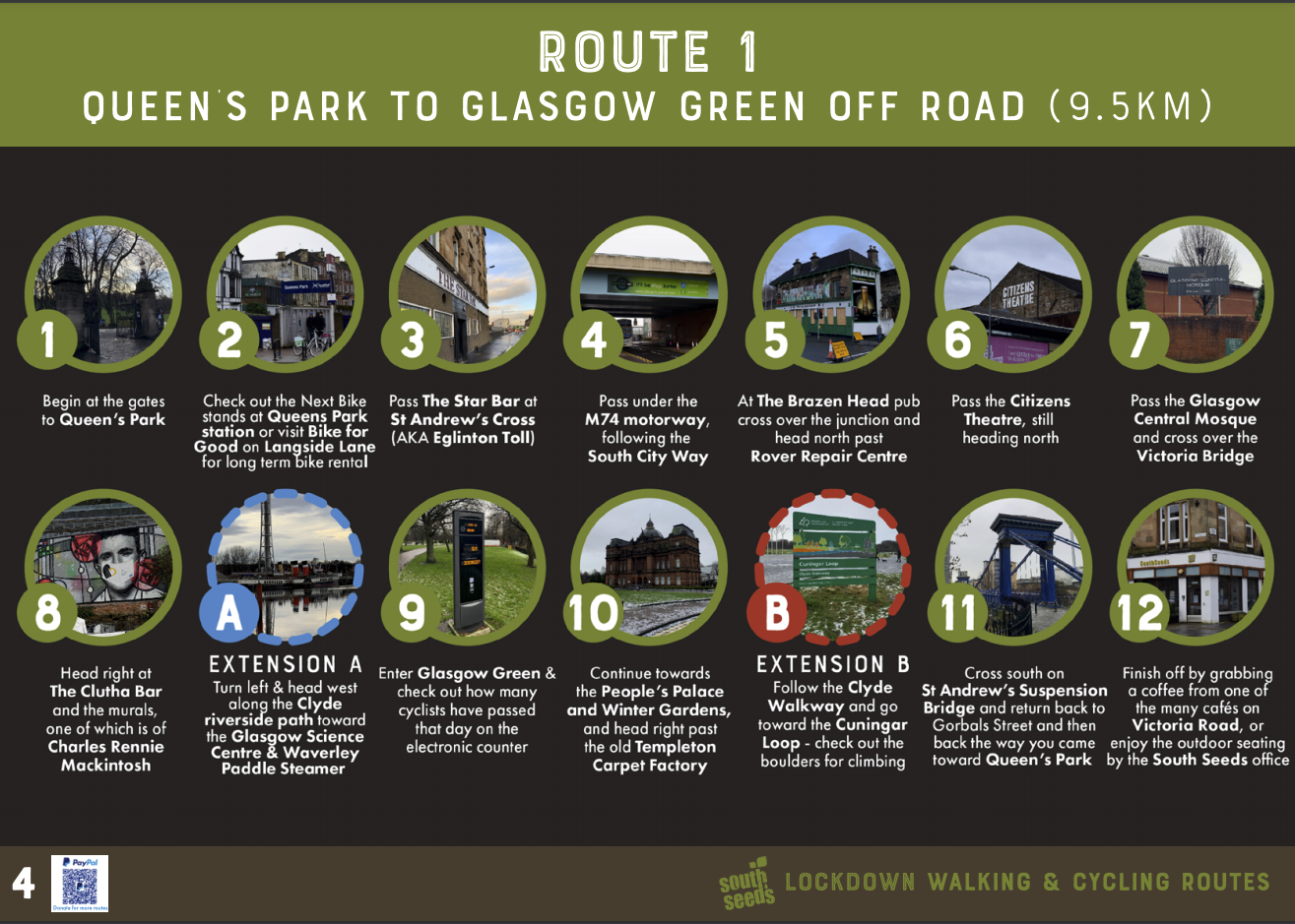
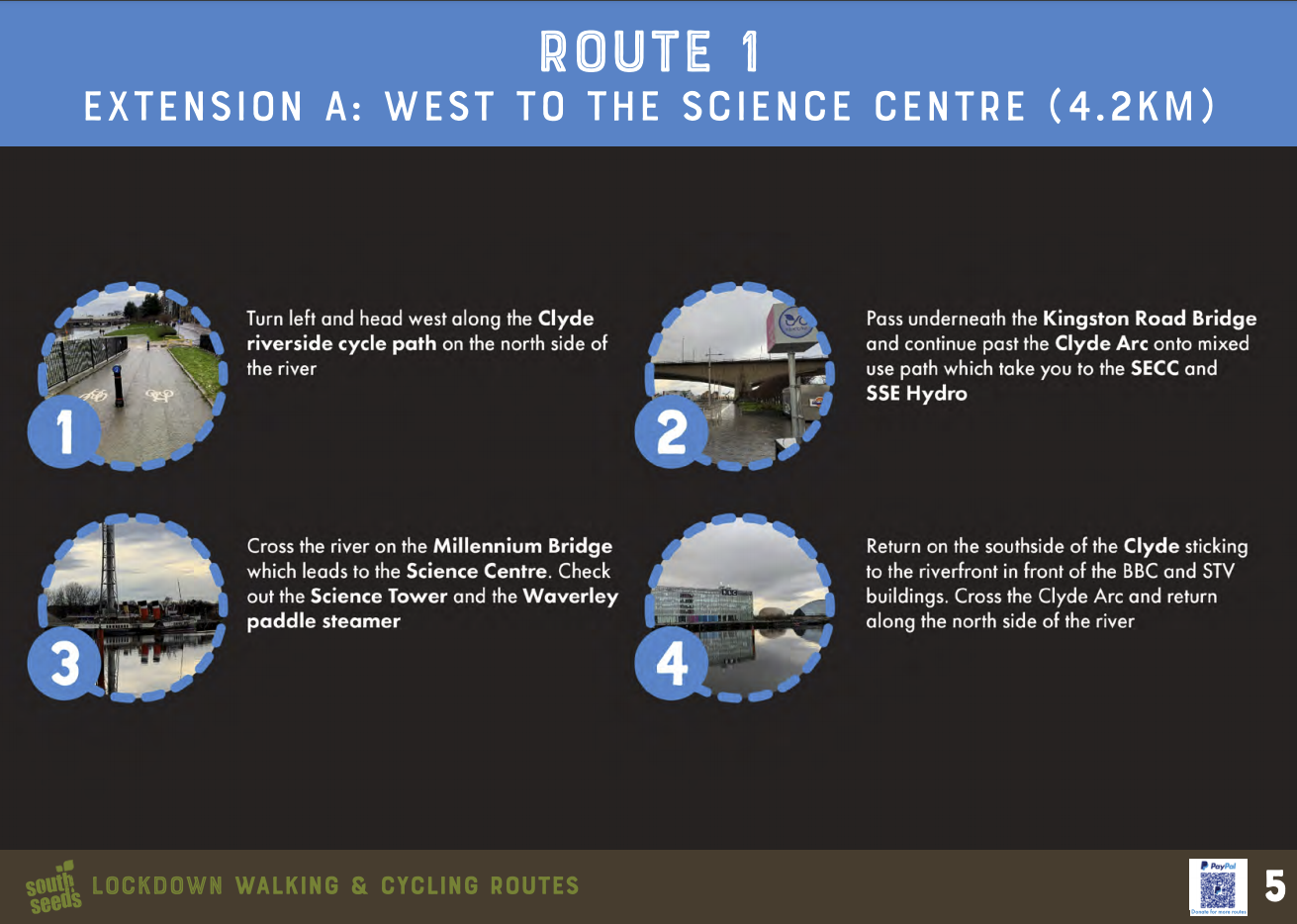
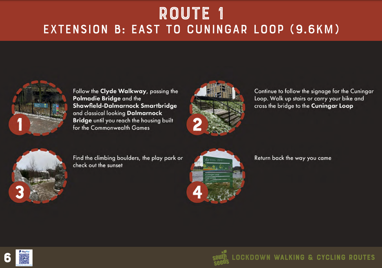
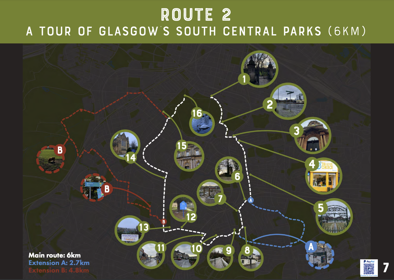
This thinking is what drove South Seeds to develop our lockdown walking and cycling routes which are available in a handy pdf booklet. There are three routes which together cover a huge area of South Central Glasgow. All routes start and end near Victoria Road, and we have been clear on the distance of each route and suggested extensions, so walkers and cyclists can plan an adventure which suits the time they have.
The routes are easy to use - they come complete with written directions, a route plotted on a map, as well as pictures taken on the route to follow. On lockdown weekends in January the routes were shared on South Seeds’ Facebook and Twitter pages so residents could tag in friends to suggest a walk.
The idea came from observing some interesting twitter accounts which invited residents to not only get out and about but look at Glasgow slightly differently. Niall Murphy’s #Momentsofbeauty shares images of some of the amazing buildings and architectural heritage in Glasgow, while Walk to work Glasgow looks at the beauty in nature that can be found in the city.
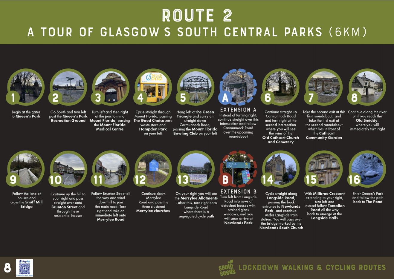
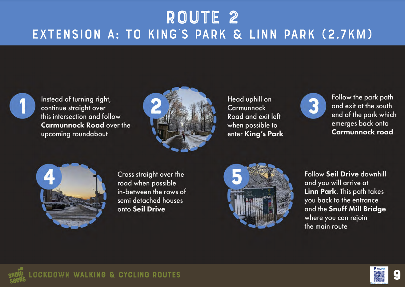
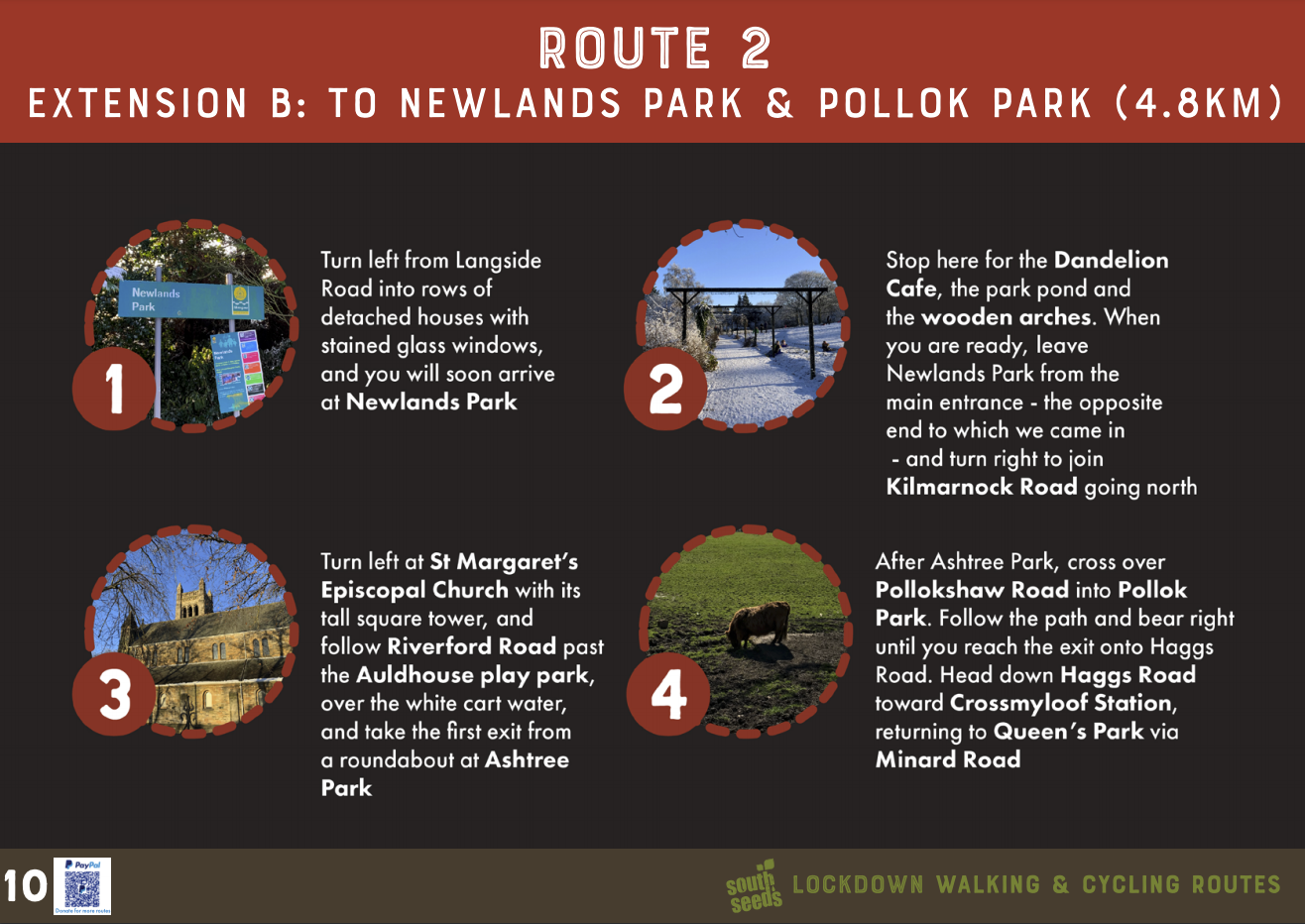
South Seeds lockdown routes show how the Southside neighbourhoods are connected. The routes use parks and off-road routes where possible, as we wanted to bring Southsiders closer to nature and the sights on their doorstep that they may well have missed pre-pandemic.
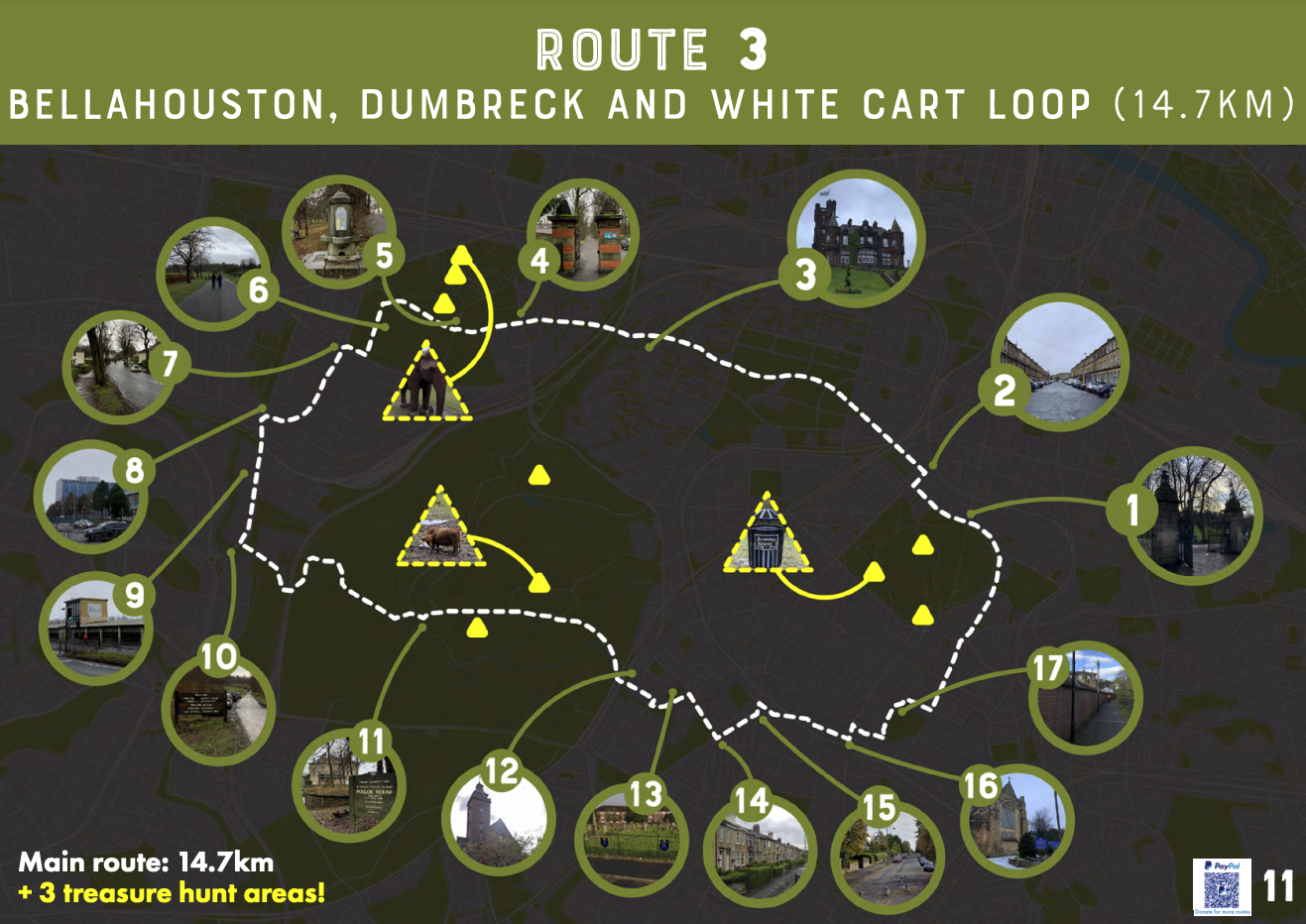
The first route features completely off-road cycling and is a mixture of segregated, painted signs and mixed use paths. This was chosen specifically to give new cyclists or those trying to build up confidence a chance to improve. From here, the routes grow in complexity and distance to offer varied and exciting things for people to see and do, linking Queen’s Park and King’s Park; Cathcart and Newlands; & Pollok and Bellahouston.
The reaction from social media has been fantastic. The likes and shares show people used the routes to make plans and got others involved. Residents told us the routes gave them an easy way to plan a day out. Some shared stories about the wildlife they had spotted; otters playing beneath St. Andrews Suspension Bridge, cormorants fishing in the Clyde and rabbits racing through Queen’s Park.
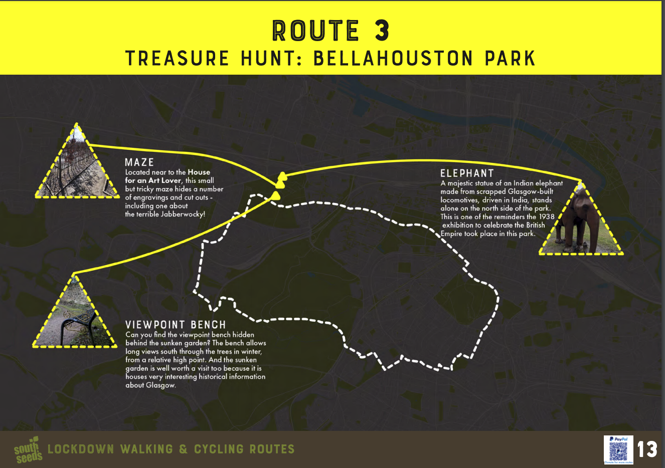
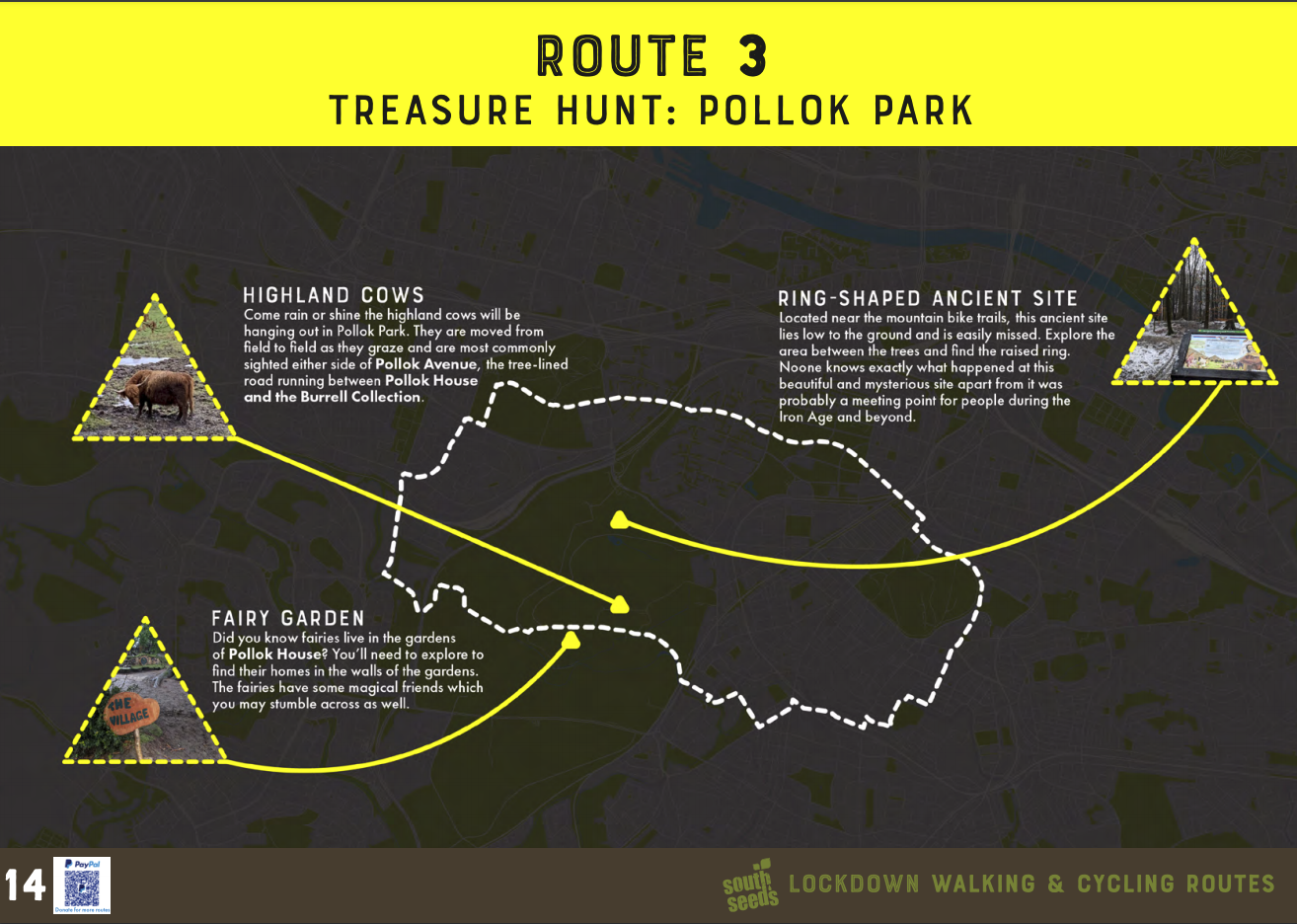
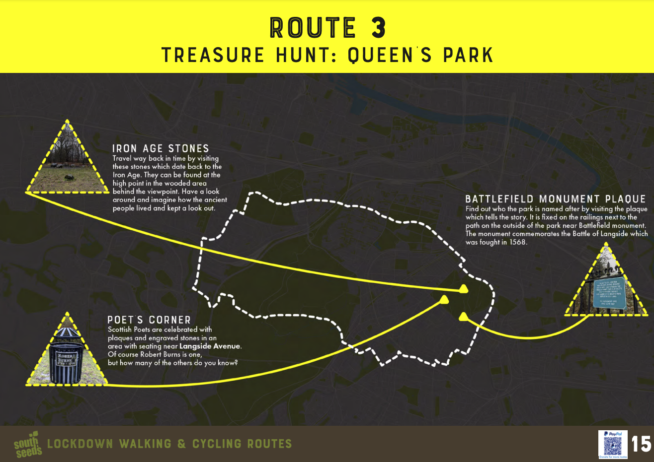
We have now added all three routes to viewranger.com, which is a platform for walking routes. If you haven’t already, it is worth checking them out. The final route in the series is a treasure hunt and it may contain some Southside landmarks you have yet to discover.
South Seeds is based on Victoria road and supports residents to lead more sustainable lives. For more information on South Seeds visit www.southseeds.org.
What have been your local discoveries during lockdown? Feel free to share in the comments below.